Service Area
Flooring in Antelope
Renaissance Floors installs and refinishes hardwood, luxury vinyl, tile, and more for homeowners throughout Antelope and the surrounding Sacramento County area.
CSLB #1060673
Licensed & Insured
Est. 2019
Family-Owned
15+ Years
Hands-On Experience
5.0★ Rated
22 Reviews on Thumbtack
Local, Licensed, Accountable
Flooring Contractor Serving Antelope
Antelope is part of Sacramento County, and it's one of the communities Renaissance Floors regularly works in. We're based in Roseville, CA and serve homeowners across Greater Sacramento & Northern California— from small refinishing jobs to full home installs. Every project starts with an honest look at your subfloor and your goals, followed by a clear, no-pressure estimate. There's no dispatched sales team and no guesswork: you work directly with the crew doing the installation, backed by our CSLB C-15 license and a workmanship warranty on every job.
Sacramento-area homes see hot, dry summers and mild winters, so solid wood can move seasonally if it isn't acclimated and sealed properly. We prep and acclimate every install for the local climate — and luxury vinyl plank is a popular, worry-free choice for busy valley households.
Antelope has no city government. Census Bureau place files list 'Antelope CDP' as a census-designated place in Sacramento County, and the 2020 Census counted 48,733 residents and 15,202 housing units on 6.84 square miles of land. Sacramento County's own page for the community, in a copy archived in 2012, drew its borders as Placer County on the north, Dry Creek and 28th Street on the west and Antelope Road on the south, and said the eastern border 'follows the Union Pacific Roseville Railyard.' That County planning line need not match the Census boundary exactly. The places around Antelope are not part of it: North Highlands, Foothill Farms, McClellan Park and Rio Linda are separate census-designated places, and Citrus Heights and Roseville are incorporated cities, Roseville in Placer County. For property inside Antelope, building permits come from Sacramento County's Building Permits and Inspection Division, which says it 'only accepts electronic plans submittal' for projects of every size.
Two decades account for most of Antelope's houses. The Census Bureau's American Community Survey for 2020–2024 puts the median year built in the Antelope census-designated place at 1993, give or take two years, against 1981 for Sacramento County. About 66 percent of housing units, give or take 4 points, were built from 1980 through 1999, a span that holds about 29 percent of the county's housing. The 1990s are the largest single decade at about 39 percent, ahead of the 1980s at about 28 percent. Both ends of the range are thin: about 5 percent of units predate 1960, and about 4 percent were built in 2010 or later. About 79 percent are one-unit detached houses, buildings of five or more units hold about 11 percent, and mobile homes are under 1 percent. Owners occupy about 70 percent of occupied homes, against 59 percent countywide. By simple arithmetic, a house from the 1980–1999 core is now roughly 26 to 46 years old.
One soil series underlies most of those houses. Measured by area inside the Census boundary, 81.9 percent of Antelope's mapped soil lies in USDA map units led by the Fiddyment series. Its official series description sets the depth to duripan at 20 to 40 inches, calls the pan an 'indurated and strongly cemented silica hardpan' and gives very slow permeability; water, it says, 'perches above the claypan for short periods after periods of high rainfall in December through April.' That describes the series wherever it is mapped, not a measurement under any Antelope house. Survey data for the two largest units, about 80 percent of the area together, rate the surface layer low for shrink-swell and the clay-rich subsoil, roughly 14 to 28 inches down, moderate in the fine sandy loam and high in the loam. The series was established in a Placer County survey in 1975, and its type location is near Mather Air Force Base, not in Antelope.
Flood mapping divides the interior from the edge. At interior points sampled on Palmerson Drive and Poker Lane, FEMA's National Flood Hazard Layer shows Zone X, minimal flood hazard. Its special flood hazard areas, Zone AE and a regulatory floodway, form a thin strip on the west and northwest edge along Dry Creek and a stream that Census mapping names Goat Creek, where sample points fall on Liveoak soil mapped as occasionally flooded. The layer shows no levee in the area. Sacramento County's 2021 hazard mitigation plan logs roadway flooding near Roseville Road and Antelope Road in 2019 and 2020, reports about roads rather than houses. The seismic record has a gap instead. The California Geological Survey has not evaluated the Citrus Heights and Rio Linda quadrangles, which cover Antelope, for liquefaction, so an unmapped zone is not a finding of low hazard. Its maps show no Alquist-Priolo fault zone nearby, and the nearest Quaternary fault it maps is about 18 miles away.
No weather station in Antelope carries NOAA's 1991–2020 normals, and the two closest temperature records disagree. The closest station with normals, a CoCoRaHS gauge called Roseville 4.7 WNW, sits 4.6 miles north in Placer County and records precipitation only, 20.20 inches a year. Sacramento 5 ESE, 11.4 miles south-southwest, averages a 94.4°F July high, a 40.7°F December low and 4.0 nights a year at or below 32°F. Sacramento Metro Airport, 12.4 miles west, averages a 93.6°F July high, a 37.2°F December low and 22.8 such nights. No source consulted explains the gap between two stations whose distances from Antelope differ by about a mile, so neither count is Antelope's. NWS Sacramento calls snow so rare that it 'may be disregarded as a climatic feature.' Humidity data come from closer: hourly readings at McClellan Airfield, about 4 miles away in McClellan Park, adjusted to 70°F with no moisture added, give a November-to-April median near 37 percent relative humidity.
Renaissance Floors is a licensed California C-15 flooring contractor (CSLB #1060673) based in Roseville. An Antelope floor project starts from the County's rules rather than a city's, from where the address sits on the flood and soil maps, and from what the slab or subfloor shows once the old floor is lifted. Free in-home estimates and a workmanship warranty.
Recent Work
A Sample of Our Craftsmanship
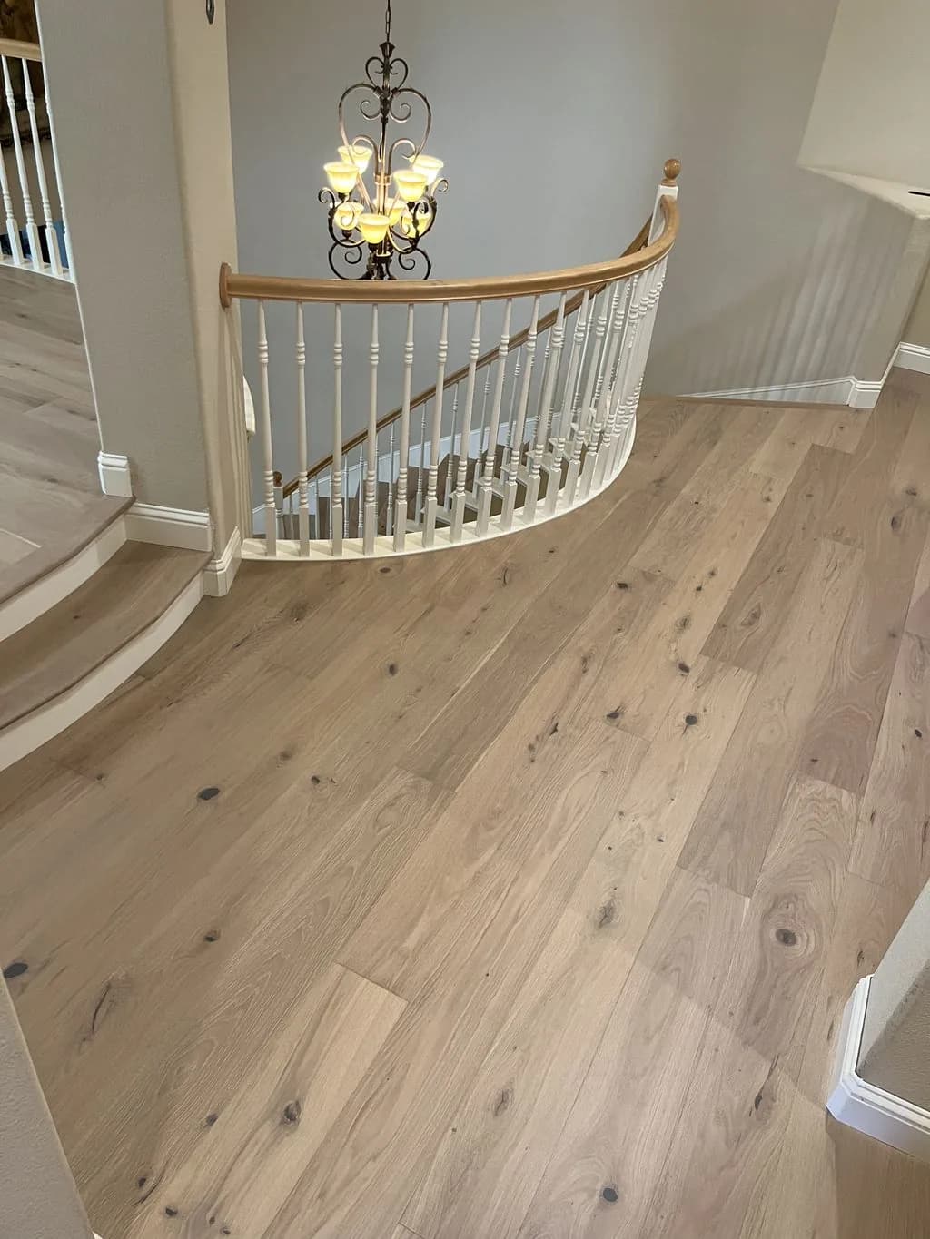
White Oak Hardwood
Great Room & Landing
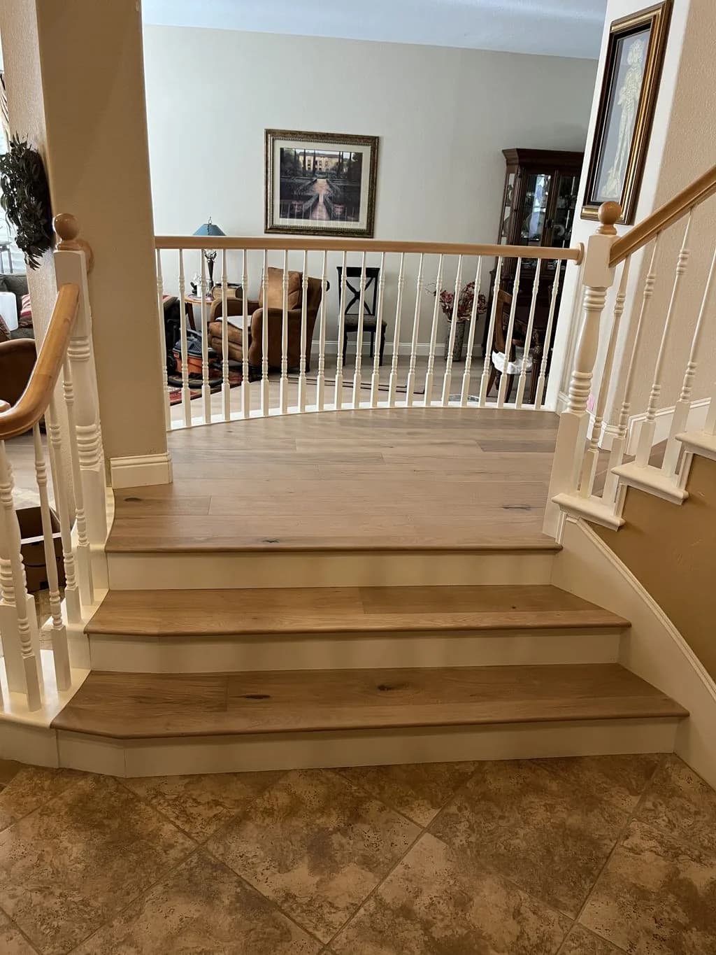
White Oak Hardwood
Staircase & Landing
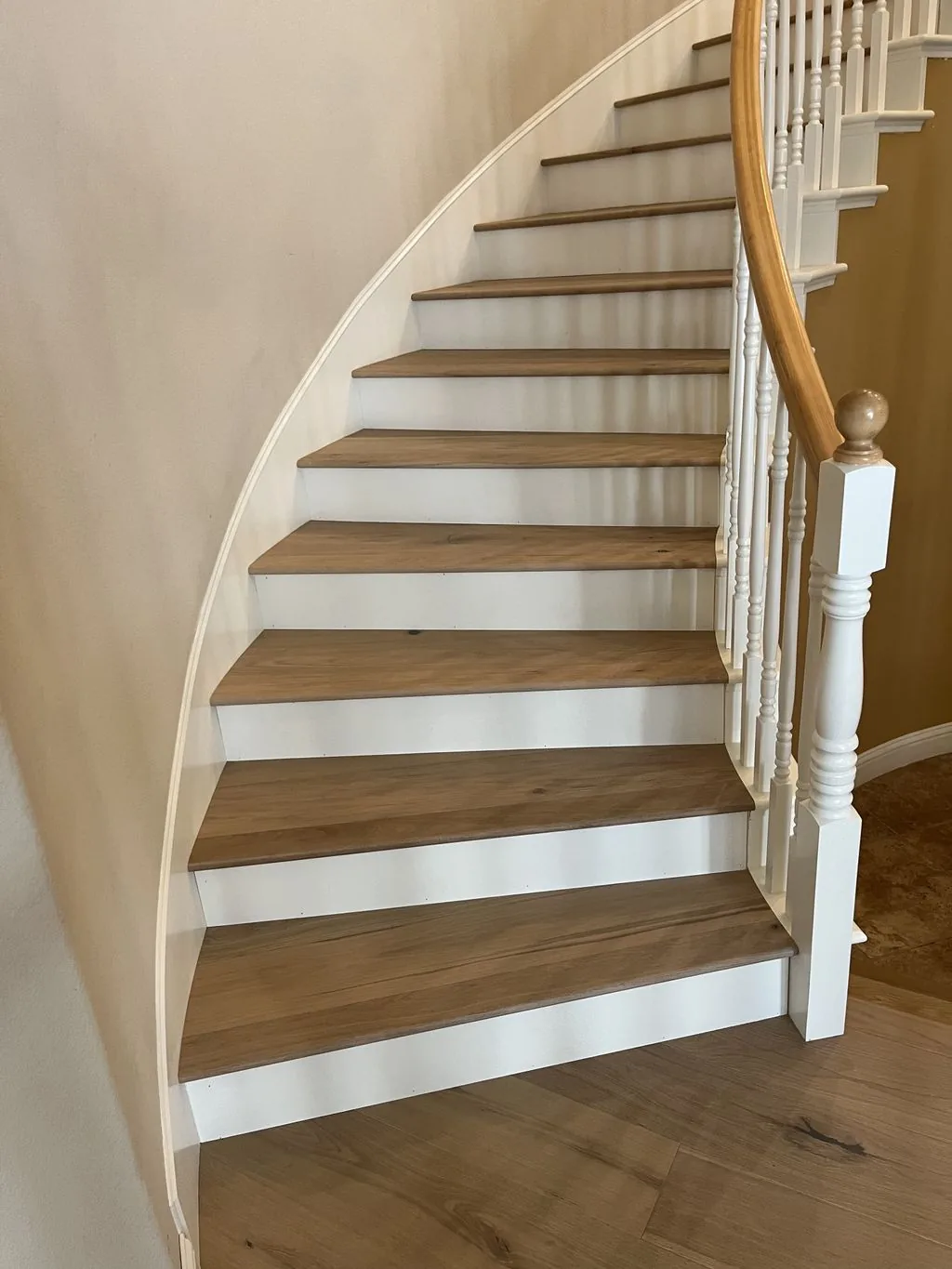
White Oak Hardwood
Curved Staircase
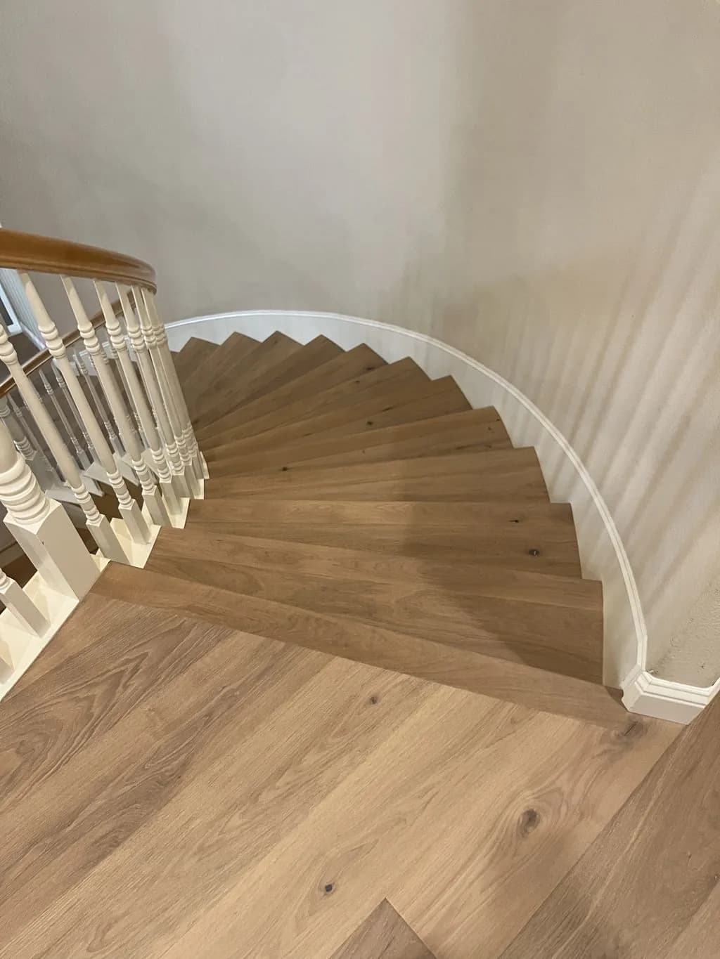
White Oak Hardwood
Stair Treads
Our Services
Flooring Services in Antelope
From hardwood to luxury vinyl, here's how we help Antelope homeowners upgrade their floors.
Hardwood Flooring
Solid oak, maple, and walkable heirloom-grade hardwood, precisely installed.
Hardwood Flooring in AntelopeEngineered Hardwood
Real-wood wear layers built for California's climate swings.
Engineered Hardwood in AntelopeLuxury Vinyl Plank
Waterproof, wood-look LVP for kitchens, baths, and busy households.
Luxury Vinyl Plank in AntelopeLaminate Flooring
Durable, high-style laminate at a friendly price point.
Laminate Flooring in AntelopeTile Flooring
Porcelain and ceramic tile set dead-level with crisp grout lines.
Tile Flooring in AntelopeFloor Installation
Full-service installation from subfloor prep to final baseboard.
Floor Installation in AntelopeFloor Refinishing
Sand, stain, and reseal tired hardwood back to new.
Floor Refinishing in AntelopeFloor Repair
Board swaps, water damage, squeaks, and seamless patch-ins.
Floor Repair in AntelopeLocal Considerations
What Antelope Homes Need From a Floor
Climate, home age, and foundation type all shape the right flooring choice in Antelope — here's what we account for.
Fiddyment hardpan under 81.9 percent of the mapped ground
Area-weighted inside the Census boundary, USDA soil survey data put 50.4 percent of Antelope in Fiddyment fine sandy loam and 30.1 percent in Fiddyment loam, with the rest of the 81.9 percent in smaller Fiddyment-led units; another 10.8 percent is an urban land complex in which Fiddyment is a minor component. Survey records place the duripan about 28 to 40 inches down in the fine sandy loam and about 28 to 34 inches down in the loam, and assign both to hydrologic group D. Linear extensibility, the survey's shrink-swell measure, is 1.5 percent in the surface layers, in the low class; 4.5 percent in the fine sandy loam's subsoil, moderate; and 7.5 percent in the loam's, high. The series description adds that water perches above the claypan for short periods after heavy December-to-April rain. None of this is a test of a lot. No map unit can say how a given slab or foundation was prepared over that subsoil; a moisture test and a straightedge on the exposed floor can.
Two-thirds of the housing from 1980 through 1999
The Census Bureau's 2020–2024 estimates for the Antelope census-designated place count about 15,500 housing units, give or take about 600, and put about 66 percent of them, give or take 4 points, in the two decades from 1980 to 1999; Sacramento County's share for those years is about 29 percent. The 2000s add about 17 percent. Everything built before 1980 comes to about 12 percent, and before 1960 about 5 percent, against roughly 20 percent countywide. By structure, about 79 percent of units are one-unit detached houses and about 6 percent one-unit attached, with buildings of five or more units at about 11 percent, roughly half the county's share. No County or state record consulted for this page states what the houses are founded on or which still have their original floors, so build year is not treated as a stand-in for either. The substrate answers those questions once the old floor is up.
The County handout lists tiling and carpeting as exempt work
Sacramento County's Building Permits and Inspection Division handout GI-21, 'Residential Work Exempt from Permit,' cites Section R105.2 and its adopted amendments, and item 6 reads: 'Painting, papering, tiling, carpeting, cabinets, counter tops and similar finish work.' Hardwood, laminate and vinyl plank are not named, so whether a given product counts as similar finish work is the County's call. The handout was last updated in May 2023, and the County says the 2025 California Building Standards Code took effect on January 1, 2026, so the current list may read differently; the County's FAQ refers applicants to section 105.2 of the California Building Code and Residential Code. Repairing a subfloor, joists or part of a slab is structural work rather than finish work, and no County text read for this page says whether it needs a permit, so ask before that work begins. When a permit is needed, the Division accepts electronic plan submittal only, and its page carries a video guide to the County's Accela Citizen Access portal.
North Highlands, Rio Linda and ZIP 95843 are not the same as Antelope
Several nearby names belong to other places. North Highlands, Foothill Farms, McClellan Park and Rio Linda each have their own Census place code as census-designated places, as does Elverta, and the Census Bureau's reference point for each lies outside Antelope's boundary. Citrus Heights and Sacramento are incorporated cities, and Roseville is a city in Placer County, which Sacramento County's description names as Antelope's northern border. ZIP code 95843 is a close but imperfect match: on a grid of sample points, about 94 percent of the Antelope census-designated place falls in the Census Bureau's ZIP code tabulation area 95843 and nearly all of 95843 falls in Antelope, while the east-side remainder of Antelope samples into areas 95621 and 95842. Tabulation areas approximate postal ZIP codes rather than reproduce them. For permits, what matters is whether the parcel is unincorporated County land or inside a city such as Citrus Heights or Roseville.
A flood strip along Dry Creek and Goat Creek on the west edge
Sampled on a grid inside the Census boundary, FEMA's National Flood Hazard Layer shows most of Antelope as Zone X, minimal flood hazard. Its special flood hazard areas, a regulatory floodway and Zone AE, lie along the west and northwest edge, nearest to Dry Creek, which the County names as the western border, and to a stream Census mapping labels Goat Creek, most of whose mapped line runs inside the boundary. Two west-edge sample points fall in the floodway on Liveoak sandy clay loam, a map unit named as occasionally flooded, where a Sacramento County flood-map panel overlaps one of Placer County's. Interior sample points sit on panels effective August 16, 2012, and February 22, 2024. The layer shows no levee near Antelope. The County's 2021 hazard mitigation plan records California Highway Patrol reports of flooded roadway near Roseville Road and Antelope Road in February 2019 and April 2020; they describe roads, not homes. If a parcel does fall in a mapped zone, that argues for ground-floor materials that tolerate water.
Liquefaction unevaluated, which is not the same as low
The California Geological Survey's seismic hazards program lists two quadrangles over Antelope, Citrus Heights and Rio Linda, among its unevaluated areas. Interior sample points, including the addresses on Palmerson Drive and Poker Lane, fall in the Citrus Heights quadrangle; the west-edge flood samples fall in Rio Linda. The quadrangles are map sheets named for places, not the city of Citrus Heights or the Rio Linda community. Because neither has been evaluated, the absence of a state liquefaction zone here says nothing either way about the hazard. The survey's maps show no Alquist-Priolo fault zone nearby, and on its fault activity map the nearest Quaternary fault is the Maidu East fault, about 18 miles from Antelope. For flooring, the practical question stays local: the condition of the slab or subfloor once it is exposed.
Two station records, air from McClellan and district finish limits
Sacramento Metro Airport's 1991–2020 normals give 17.97 inches of precipitation a year, 83 percent of it from November through March, and 83.9 days a year at 90°F or above; Sacramento 5 ESE's give 19.20 inches and 89.9 such days. Neither station is in Antelope. Humidity figures come from the station at McClellan Airfield, about 4 miles away: hourly outdoor air from 2015 to 2025, computed at 70°F with no moisture added, falls below 30 percent relative humidity in about 19 percent of November-to-April hours, and its June-to-September median is 52.5 percent. Converted with the USDA Wood Handbook's equilibrium moisture formula, median heating-season air corresponds to about 7.3 percent moisture content in wood and median summer air to about 9.6 percent. Because the readings come from an airfield, not a living room, acclimation is done indoors under the home's normal climate control. Site-applied finishes fall under the Sacramento Metropolitan Air Quality Management District, whose Rule 442 limits wood coatings to 275 grams of VOC per liter, stains to 250 and floor coatings to 100.
Local Resources & References
Helpful Antelope Resources
Authoritative local and industry references for permits, planning, and flooring standards.
- GI-21, Residential Work Exempt from Permit (last updated 5/2023) — item 6, 'tiling, carpeting … and similar finish work'Sacramento County
- Building Permits & Inspection Division — electronic plan submittal only; 2025 California Building Standards Code effective January 1, 2026Sacramento County
- About Antelope (Wayback Machine snapshot, May 26, 2012) — community borders: Placer County, Dry Creek and 28th Street, Antelope Road, the Union Pacific Roseville RailyardSacramento County
- ACS 2020–2024 5-year — year built, median year built, units in structure and tenure, Antelope CDP (place 0602210)US Census
- Official Series Description, Fiddyment series — duripan 20 to 40 inches; water perched above the claypan after heavy December–April rainUSDA Natural Resources Conservation Service
- 1991–2020 monthly normals, Sacramento Metro Airport (USW00093225) — 12.4 miles west of AntelopeNOAA NCEI
- Climate of Sacramento, California (rev. 2010) — snow 'may be disregarded as a climatic feature'NWS Sacramento
- Seismic Hazards Program: Unevaluated Areas — the Citrus Heights and Rio Linda quadrangles, not evaluated for liquefactionCalifornia Geological Survey
- National Flood Hazard Layer — Zone X in the interior; Zone AE and floodway along Dry Creek and Goat Creek at the west edgeFEMA
External links are provided for reference. Always confirm current requirements with the issuing agency.
Explore Flooring Services in Antelope
Good to Know
Frequently Asked Questions
Does Renaissance Floors serve Antelope?
Yes. We install and refinish flooring throughout Antelope and the surrounding Sacramento County area. Call (916) 749-0272 for a free estimate.
What flooring services do you offer in Antelope?
We install hardwood, engineered wood, luxury vinyl plank, laminate, tile, and more in Antelope, plus floor refinishing, repair, and full-service installation. See the full list below.
Are you licensed to work in Antelope?
Yes. We hold CSLB C-15 license #1060673 (C-15 Flooring & Floor Covering) and carry insurance. We're based in Roseville, CA and serve Antelope and all of Greater Sacramento & Northern California.
How do I get a free flooring estimate in Antelope?
Call (916) 749-0272 or request an estimate online. We'll schedule a convenient in-home visit in Antelope, measure your space, and give you an honest, no-pressure quote.
Is Antelope a city?
No. Antelope is an unincorporated community that the Census Bureau lists as a census-designated place in Sacramento County, so it has no city council or city building department. Sacramento County's Building Permits and Inspection Division handles permits there and accepts plans electronically only. Nearby North Highlands, Foothill Farms, McClellan Park and Rio Linda are separate census-designated places, and Citrus Heights and Roseville are separate incorporated cities.
Is ZIP code 95843 the same as Antelope?
Nearly, but not exactly. On a grid of sample points, about 94 percent of the Antelope census-designated place falls in the Census Bureau's ZIP code tabulation area 95843, and nearly all of 95843 falls inside Antelope. The parts of Antelope outside 95843 lie on its east side, in areas 95621 and 95842. Tabulation areas only approximate postal ZIP codes, so a 95843 address is a strong hint, not proof, of where a property sits.
How old are most Antelope homes?
Most date from 1980 through 1999. Census Bureau estimates for 2020–2024 put Antelope's median year built at 1993, give or take two years, compared with 1981 for Sacramento County. About 39 percent of housing units were built in the 1990s and about 28 percent in the 1980s, while about 5 percent predate 1960. About 79 percent are one-unit detached houses, and owners occupy about 70 percent of occupied homes.
Do I need a permit to replace flooring in Antelope?
The County's handout names tiling and carpeting as exempt, and no other floor type. Sacramento County's GI-21 lists 'Painting, papering, tiling, carpeting, cabinets, counter tops and similar finish work' as work not requiring a permit. Hardwood, laminate and vinyl plank do not appear by name, the handout was last updated in May 2023, and the 2025 code took effect January 1, 2026. Subfloor, joist or slab repair is structural, so confirm it with the County.
What soil are Antelope homes built on?
Mostly Fiddyment soils. USDA soil survey mapping puts 81.9 percent of Antelope's mapped area in Fiddyment-led map units. The series description gives a cemented silica hardpan 20 to 40 inches down and says water perches above the claypan for short periods after heavy December-to-April rain. Survey data rate the surface layer low for shrink-swell and the subsoil moderate to high. These are map shares, not tests of any single lot.
Is my Antelope home in a flood zone?
Most of Antelope is not, but check the address. At sampled interior points, FEMA's flood map shows Zone X, minimal flood hazard. Its mapped Zone AE and floodway areas form a thin strip on the west and northwest edge along Dry Creek and a stream Census mapping names Goat Creek. Sacramento County's hazard plan logs roadway flooding near Roseville Road and Antelope Road in 2019 and 2020, not flooded houses. FEMA's map shows whether a specific parcel is mapped.
Is liquefaction a concern in Antelope?
No state finding exists either way. The California Geological Survey lists the Citrus Heights and Rio Linda quadrangles, which cover Antelope, as unevaluated for liquefaction, so the lack of a mapped zone does not mean the hazard is low. The survey's maps show no Alquist-Priolo fault zone nearby, and the nearest Quaternary fault it maps is about 18 miles away. On a flooring job, what can be judged is the exposed slab or subfloor.
Does Antelope get freezing weather?
Both nearby temperature stations record frost, in very different amounts. No NOAA temperature station sits in Antelope. Sacramento Metro Airport, 12.4 miles west, averages 22.8 nights a year at or below 32°F and a 37.2°F December low under its 1991–2020 normals, while Sacramento 5 ESE, 11.4 miles south-southwest, averages 4.0 such nights. NWS Sacramento says snow is so rare that it 'may be disregarded as a climatic feature.'

Ready for Floors You'll Love?
Free, no-pressure flooring estimates throughout Antelope and Sacramento County.