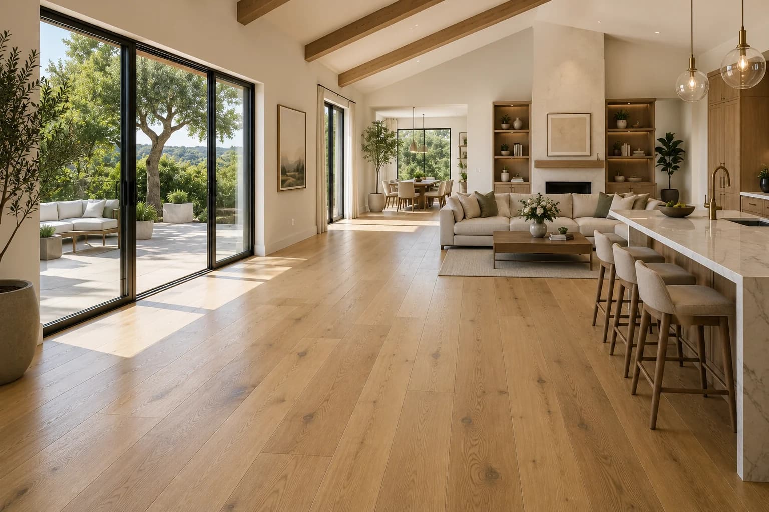
Service Area
Flooring in Livermore
Renaissance Floors installs and refinishes hardwood, luxury vinyl, tile, and more for homeowners throughout Livermore and the surrounding Alameda County area.
CSLB #1060673
Licensed & Insured
Est. 2019
Family-Owned
15+ Years
Hands-On Experience
5.0★ Rated
22 Reviews on Thumbtack
Local, Licensed, Accountable
Flooring Contractor Serving Livermore
Livermore is part of Alameda County, and it's one of the communities Renaissance Floors regularly works in. We're based in Roseville, CA and serve homeowners across Greater Sacramento & Northern California— from small refinishing jobs to full home installs. Every project starts with an honest look at your subfloor and your goals, followed by a clear, no-pressure estimate. There's no dispatched sales team and no guesswork: you work directly with the crew doing the installation, backed by our CSLB C-15 license and a workmanship warranty on every job.
From Oakland and Berkeley bungalows to Tri-Valley new builds, East Bay homes span a century of construction. We refinish beautiful original hardwood where it makes sense and install fresh floors where it doesn't.
Livermore's history has two starting dates. The city's Historic Resources page dates its founding to 1869, the year the city-commissioned Historic Context Statement of March 2021 gives for the platting of the original town and the completion of the Central Pacific Railroad; the same statement records that Livermore incorporated in 1876 with a population of over eight hundred. The name is older. California Historical Landmark No. 241, in Portola Park, records that Robert Livermore, born in England in 1799, settled on his Rancho las Positas in 1835. The statement calls the city 'arguably best known for its wine production and annual rodeo,' but the wine country does not sit neatly inside it. The Census geocoder places Concannon Vineyard, founded by James Concannon in 1883, at 4590 Tesla Road inside city limits, and Wente Bros. Winery at 5565 Tesla Road and the Cresta Blanca landmark at 5050 Arroyo Road on unincorporated land.
Most of today's city is postwar, and the Lab is part of the reason. The Historic Context Statement dates the ordinance allowing subdivisions to 1950 and the first subdivision, the Jensen Tract of about fifty homes north of East Avenue, to 1951; Lawrence Livermore National Laboratory opened in 1952, and its 7000 East Avenue address geocodes inside city limits. By 1960 the population was over sixteen thousand, and after a section of Interstate 580 was completed through the valley in the mid-1960s, the statement says, the population 'grew exponentially as apartment buildings and massive tracts of new homes were constructed.' The Census Bureau's 2020–2024 five-year estimates count about 32,000 housing units and put the median year built at 1979. Nearly half were built from 1950 through 1979, and under 3 percent predate 1940. About four in five are single-unit homes, and renters occupy about 28 percent of occupied homes. A build year raises questions about what lies under a floor; it doesn't answer them.
The city's own permit handout names two floor coverings. Livermore's 'Work Exempt from Building Permit' handout, updated May 1, 2023, lists 'painting, papering, floor tiling and carpeting, cabinets and counter tops without plumbing and similar finish work.' Hardwood, laminate and vinyl plank are not named, so whether they count as similar finish work is a question for the city, and nothing on the list covers subfloor or structural repair, plumbing or electrical work. The date matters. The city's code-adoption handout ends with the 2022 California Building Code, effective January 1, 2023, and the current municipal code host blocked retrieval, so this page cannot say whether Livermore has adopted the 2025 codes or changed the list. Permits are filed online only; the Permit Center says they are 'no longer available over the counter.' Historic review turns on whether a floor is character-defining: the Development Code exempts 'Modifying interior features, surfaces, and furnishings not identified as a character-defining feature' from a certificate of appropriateness.
The ground changes over short distances. USDA soil survey data map downtown and a Tesla Road point near Concannon Vineyard as Livermore very gravelly coarse sandy loam, in the lowest shrink-swell class, while a sampled point near the airport maps as Diablo clay, whose official series description records dry-season cracks 1/2 to 2 inches wide. A derived citywide estimate from the same data puts about 11 percent of Livermore's mapped area in the high or very high classes, the smallest such share of the five Tri-Valley cities, although Pleasanton has more ground in the lowest class. State maps add more: Alquist-Priolo Earthquake Fault Zones on the Altamont quadrangle, released in 1982, reach an estimated 0.7 square miles of eastern Livermore, where the traces are the Greenville and Los Positas faults. Liquefaction zones, which require investigation for new development, cover about 48 percent of the city's area by a grid estimate. FEMA maps Zone AE at a sampled point on Arroyo del Valle, and CAL FIRE's 2025 local map shows Moderate and High zones in the city but no Very High.
Livermore's weather record comes from Livermore Municipal Airport, about 3 miles from the Census Bureau's internal point for the city. NOAA's 1991–2020 normals there give July an 87.7°F average high, 16°F above the Oakland Museum station, and December the coldest average low, 37.5°F; precipitation totals 15.18 inches a year, with February the wettest month. Across the Julys of 2015 to 2024 the airport averaged 79 percent relative humidity at 4 AM and 34 percent at 4 PM, a swing of about 45 points against about 20 at Oakland International Airport, whose afternoons were about twice as humid. Among the 23 stations in this site's humidity data that swing ranks 11th, wider than every bay-side airport and narrower than Concord's Buchanan Field. Water differs by address, too. Two water providers serve Livermore city limits, and Cal Water's 2025 report averages its local groundwater at 315 parts per million of hardness, in the range it calls very hard, and Zone 7 surface water at 88.
Renaissance Floors is a licensed California C-15 flooring contractor (CSLB #1060673) based in Roseville. For a Livermore project we start with what the records raise: whether the address is inside city limits, whether the work stays within finish flooring or reaches the subfloor, plumbing or a kitchen or bath remodel, what the soil and the slab or framing underneath are doing, and whether a historic home's floor has been identified as character-defining. Free in-home estimates and a workmanship warranty.
Local Coverage
Neighborhoods We Serve in Livermore
From Downtown Livermore to Springtown, Renaissance Floors installs and refinishes floors across Livermore.
Recent Work
A Sample of Our Craftsmanship
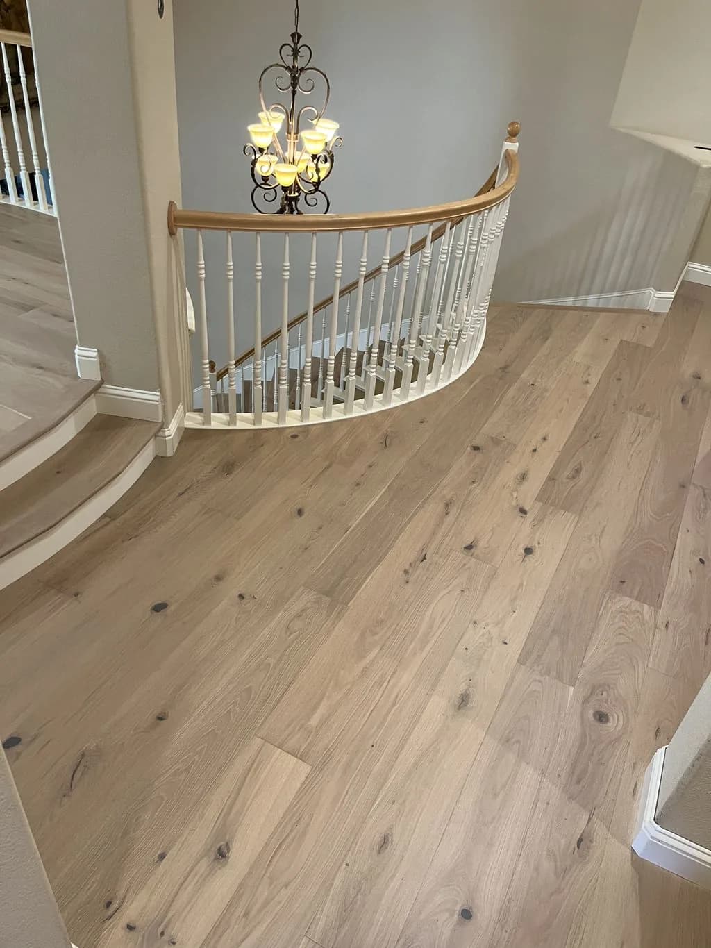
White Oak Hardwood
Great Room & Landing
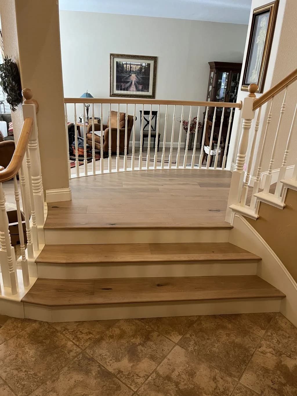
White Oak Hardwood
Staircase & Landing
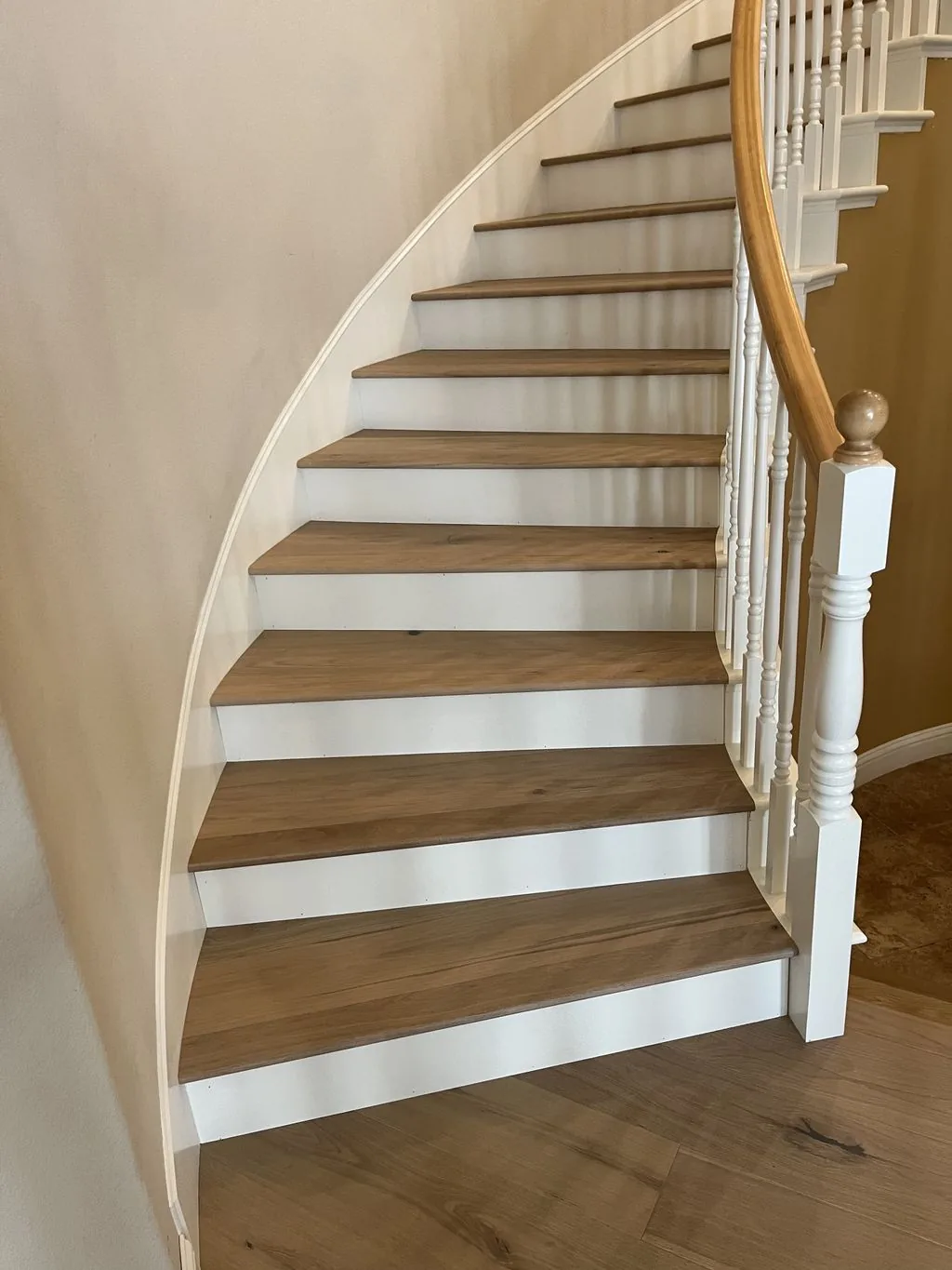
White Oak Hardwood
Curved Staircase
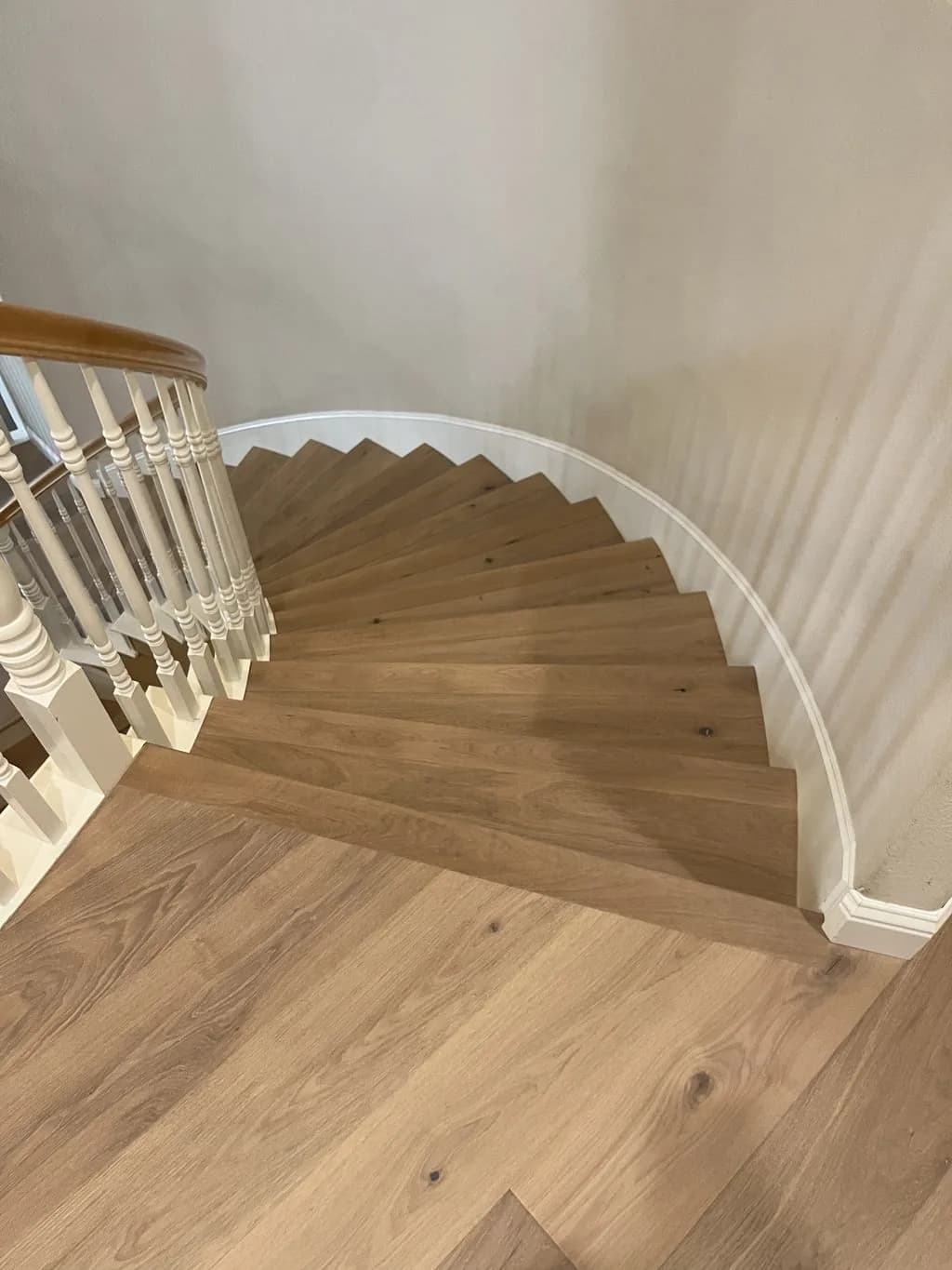
White Oak Hardwood
Stair Treads
Our Services
Flooring Services in Livermore
From hardwood to luxury vinyl, here's how we help Livermore homeowners upgrade their floors.
Hardwood Flooring
Solid oak, maple, and walkable heirloom-grade hardwood, precisely installed.
Hardwood Flooring in LivermoreEngineered Hardwood
Real-wood wear layers built for California's climate swings.
Engineered Hardwood in LivermoreLuxury Vinyl Plank
Waterproof, wood-look LVP for kitchens, baths, and busy households.
Luxury Vinyl Plank in LivermoreLaminate Flooring
Durable, high-style laminate at a friendly price point.
Laminate Flooring in LivermoreTile Flooring
Porcelain and ceramic tile set dead-level with crisp grout lines.
Tile Flooring in LivermoreFloor Installation
Full-service installation from subfloor prep to final baseboard.
Floor Installation in LivermoreFloor Refinishing
Sand, stain, and reseal tired hardwood back to new.
Floor Refinishing in LivermoreFloor Repair
Board swaps, water damage, squeaks, and seamless patch-ins.
Floor Repair in LivermoreLocal Considerations
What Livermore Homes Need From a Floor
Climate, home age, and foundation type all shape the right flooring choice in Livermore — here's what we account for.
Floor tiling and carpeting are on the city's exempt list, and the code edition is unconfirmed
The City of Livermore's 'Work Exempt from Building Permit' handout, updated May 1, 2023, lists as item 6 'Painting, papering, floor tiling and carpeting, cabinets and counter tops without plumbing and similar finish work,' alongside items such as fences not over 6 feet high and driveway replacement. Hardwood, laminate and vinyl plank are not named, so whether they fall under similar finish work is a question for the Permit Center rather than an assumption either way, and nothing on the list covers subfloor, joist or structural repair, plumbing or electrical work. The municipal code copy retrieved for this page amends the state exempt-work sections to delete electrical, gas, mechanical and plumbing items, which it says are addressed in Livermore's own electrical, mechanical and plumbing codes, and neither amendment touches the finish-work item. That copy may be out of date: the city now hosts its code on a platform that blocked retrieval, and its Building Code Adoption Dates handout ends with the 2022 California Building Code, effective January 1, 2023. Whether Livermore has adopted the 2025 codes, and whether the list changed with them, could not be verified. Remodels are a separate track; the city's Kitchen and Bath Remodels handout, updated January 2025, says to submit through online permitting and requires a floor plan of the existing and proposed layout.
Wine country straddles the city line
A Livermore mailing address does not settle who issues a permit. The Census geocoder places Concannon Vineyard at 4590 Tesla Road inside city limits, but Wente Bros. Winery at 5565 Tesla Road and the Cresta Blanca Winery landmark at 5050 Arroyo Road on unincorporated land, and sampled points south of the city geocode the same way. The city describes its South Livermore Valley Specific Plan as covering 'an approximately 1,891-acre unincorporated area along the City of Livermore's southern boundary,' and the Historic Context Statement notes that 'More extensive agricultural use lies outside the city in unincorporated areas.' Inside the city, permits go through the Permit Center at 1052 South Livermore Avenue, (925) 960-4410. Its June 2026 page says 'ALL PERMITS ARE EXCLUSIVELY ONLINE' through the city's Accela Citizen Access portal and that permits are 'no longer available over the counter'; office hours are Monday through Thursday, 9 a.m. to 4 p.m., and the counter is closed Fridays. The Building Division page puts plan review at 15 minutes to 25 business days, depending on complexity and workload, and inspections within 24 hours of a request. A parcel outside city limits is not the city's to permit, so confirm the boundary first.
Interior surfaces are exempt from historic review unless character-defining
Livermore's Historic Resources Inventory is, in the city's words, 'a Citywide list of all approximately 30,000 parcels in Livermore,' each analyzed for potential historic significance, and the city names Hagemann Ranch and the Carnegie Library as examples listed as historically significant. The Development Code requires a certificate of appropriateness to alter a historical resource or a potential historical resource, and it counts changes to 'surface texture' among alterations. Section 9.02.110(A), though, lists routine work that needs no certificate, including 'Modifying interior features, surfaces, and furnishings not identified as a character-defining feature.' The code says character-defining features 'may include the building material, window and door placement and design, architectural arrangement, massing, roof form, texture, paint, etc.,' and alteration of one goes to the Historic Preservation Commission. A floor is exempt unless it has been identified as character-defining, not automatically. The Hagemann Ranch Historic District at 455 Olivina Avenue, listed by the state Office of Historic Preservation with a registration date of January 10, 2008, documents 'plank-frame' construction alongside typical wood-frame and post-and-beam building. The code copy read for this page is marked revised May 2021, so the owner of an inventoried property confirms its status with the city.
A postwar city with a median home from around 1979
The Census Bureau's 2020–2024 five-year estimates count about 32,000 housing units in Livermore and put the median year built at 1979, give or take two years. The 1960s and 1970s account for about 18 percent each, too close to rank; the 1990s about 15 percent; the 1980s about 12; the 1950s and 2000s about 11 each; and the 2010s about 8. Under 3 percent predate 1940. That spread follows the city's history: the Historic Context Statement dates the subdivision ordinance to 1950, the Jensen Tract, built by developer Roy Jensen along Jensen Street, Princeton Way, Harvard Way and Atomic Street (now Estates Street), to 1951, and the opening of Lawrence Livermore National Laboratory to 1952. About 69 percent of units are detached houses and about 12 percent attached, so roughly four in five are single-unit homes; about 14 percent sit in buildings of five or more units, a few hundred are mobile homes, and renters occupy about 28 percent of occupied homes. Those are counts, not inspections. A build year says what to look for under a finished floor, not what is there, and a rented or association-governed home adds another party to the decision.
Gravel downtown, shrink-swell clay at other sampled points
USDA soil survey data, checked at points inside city limits, show two very different grounds. Downtown and on Tesla Road near Concannon Vineyard the map unit is Livermore very gravelly coarse sandy loam, with a representative linear extensibility, a measure of shrink-swell, of 1.5 percent, in the lowest class. The official description of the series, established in the Livermore Area survey of 1910 and named for the area, calls these 'very deep, somewhat excessively drained soils that formed in very gravelly alluvium.' Near the airport the map unit is Diablo clay, at 7.5 in the high class, and the Diablo description, whose type location is about 3 miles northeast of Livermore, says dry soils have 'cracks 1/2 to 2 inches wide from the surface to a depth of 20 to 40 inches' that close with wetting beginning in late October to late November. In the Springtown area, Pescadero clay loam averages about 7.5, with a subsoil layer at 8.3. A derived citywide estimate from the same data puts about 11 percent of Livermore's mapped area in the high or very high classes, the smallest share of the five Tri-Valley cities and far below Danville's roughly 78 percent, though Pleasanton has more ground in the lowest class, about 46 percent against Livermore's 33. These are points and area estimates, not parcel tests.
Fault zones in the east, liquefaction zones, and a mapped floodplain on Arroyo del Valle
The California Geological Survey's Alquist-Priolo Earthquake Fault Zones on its Altamont quadrangle map, released in 1982, reach into eastern Livermore; a grid estimate puts about 0.7 square miles, roughly 2.6 percent of the city, inside them. The fault traces the survey maps inside city limits belong to the Greenville fault and the Los Positas fault, as the survey spells it. Its liquefaction zones for the Livermore quadrangle, released August 27, 2008, and the Altamont quadrangle, released February 27, 2009, cover about 48 percent of the city's area by the same kind of estimate, and landslide zones from the same releases also reach the city. These are zones of required investigation for new development, not predictions of damage to any house. FEMA's flood map puts a sampled point on Arroyo del Valle inside the city in Zone AE, a special flood hazard area, while sampled downtown and Springtown-area points are in Zone X with minimal hazard and a point near the airport is in the 0.2-percent-annual-chance zone. CAL FIRE's local responsibility area map dated March 24, 2025 shows Moderate and High fire hazard severity zones intersecting the city and no Very High; whether the city has adopted that map was not verified. A mapped zone is a reason to check the parcel itself, and water-tolerant flooring is worth weighing for a ground-floor room in a mapped flood zone.
A wide July humidity swing at Livermore Municipal Airport, and dry heated air
NOAA's 1991–2020 normals at Livermore Municipal Airport, about 3 miles from the Census Bureau's internal point for the city, give an 87.7°F July average high over a 56.6°F low, and December the coldest average low, 37.5°F, just below January's 37.8°F. Annual precipitation is 15.18 inches, with February the wettest month at 2.92; a second NOAA station, Livermore COOP, puts the wettest month in January and the July high at 89.0°F, so the two records differ in detail. The gap between the warmest and coldest monthly averages is 24.6°F at the airport and 13.5°F at the Oakland Museum station. Across the Julys of 2015 to 2024 the airport averaged 79.2 percent relative humidity at 4 AM and 34.0 percent at 4 PM, a 45-point swing; among the 23 stations in this site's humidity data that ranks 11th, wider than every bay-side airport, including Oakland International at about 20 points, and narrower than inland stations such as Concord's Buchanan Field. Those are outdoor readings. For indoor air, hourly observations at the airport from 2015 to 2025, warmed to 70°F with no moisture added, give a November-to-April median of about 36 percent relative humidity, with more than a quarter of those hours below 30 percent, and a June-to-September median of about 53 percent. Acclimation happens in the conditioned house, not against airport weather.
Local Resources & References
Helpful Livermore Resources
Authoritative local and industry references for permits, planning, and flooring standards.
- Work Exempt from Building Permit handout, updated May 1, 2023 (Wayback Machine snapshot; the live city site blocks automated retrieval) — item 6 names 'floor tiling and carpeting'City of Livermore
- Permit Center (Wayback Machine snapshot, June 7, 2026) — 'ALL PERMITS ARE EXCLUSIVELY ONLINE'; address, phone and counter hoursCity of Livermore
- Historic Context Statement (GPA Consulting, March 2021; Wayback Machine snapshot) — incorporation in 1876, the 1950 subdivision ordinance, the Jensen Tract and the LaboratoryCity of Livermore
- Development Code Part 9, Chapter 9.02 Historic Preservation (revised 5/21) — §9.02.110(A)(5) exemption for interior surfaces not identified as character-definingCity of Livermore
- ACS 2020–2024 5-year — housing units, year built, median year built, units in structure and tenure, Livermore city (place 0641992)US Census
- 1991–2020 monthly normals, Livermore Municipal Airport (USW00023285)NOAA NCEI
- Official Series Description, Livermore series — very gravelly alluvium, established in the Livermore Area survey of 1910USDA Natural Resources Conservation Service
- Earthquake Zones of Required Investigation map — Alquist-Priolo fault zones and liquefaction zones (Livermore quadrangle released 2008, Altamont 2009)California Geological Survey
- Livermore District 2025 Water Quality Report — hardness by source and the utility's hardness classesCalifornia Water Service
External links are provided for reference. Always confirm current requirements with the issuing agency.
Explore Flooring Services in Livermore
Good to Know
Frequently Asked Questions
Does Renaissance Floors serve Livermore?
Yes. We install and refinish flooring throughout Livermore and the surrounding Alameda County area. Call (916) 749-0272 for a free estimate.
What flooring services do you offer in Livermore?
We install hardwood, engineered wood, luxury vinyl plank, laminate, tile, and more in Livermore, plus floor refinishing, repair, and full-service installation. See the full list below.
Are you licensed to work in Livermore?
Yes. We hold CSLB C-15 license #1060673 (C-15 Flooring & Floor Covering) and carry insurance. We're based in Roseville, CA and serve Livermore and all of Greater Sacramento & Northern California.
How do I get a free flooring estimate in Livermore?
Call (916) 749-0272 or request an estimate online. We'll schedule a convenient in-home visit in Livermore, measure your space, and give you an honest, no-pressure quote.
Do I need a building permit to replace flooring in Livermore?
Floor tiling and carpeting are on the city's exempt list; other floor types aren't named. Livermore's 'Work Exempt from Building Permit' handout, updated May 1, 2023, lists 'painting, papering, floor tiling and carpeting, cabinets and counter tops without plumbing and similar finish work.' Subfloor, structural, plumbing and electrical work aren't on it, and whether the city has since adopted the 2025 codes couldn't be verified. Permits are filed online only, so confirm your scope with the Permit Center at (925) 960-4410.
My Livermore address is in the wine country. Does the city issue my permit?
Not necessarily. The wine country along Tesla Road straddles the city line: the Census geocoder places 4590 Tesla Road, Concannon Vineyard, inside city limits, but 5565 Tesla Road, Wente Bros. Winery, on unincorporated land. The city describes its South Livermore Valley Specific Plan area as 'an approximately 1,891-acre unincorporated area along the City of Livermore's southern boundary.' A Livermore mailing address doesn't settle it, so confirm whether the parcel is inside city limits before applying.
My home is on Livermore's historic inventory. Can I change the floors?
Yes, without a certificate of appropriateness, unless the floor has been identified as character-defining. Livermore's Development Code exempts 'Modifying interior features, surfaces, and furnishings not identified as a character-defining feature' from that certificate. Alteration of a character-defining feature of a historical resource goes to the Historic Preservation Commission. The inventory covers about 30,000 parcels citywide, and the code copy read for this page is marked revised May 2021, so confirm a property's status with the city first.
How old are most Livermore homes?
Mostly postwar. The Census Bureau's 2020–2024 estimates put Livermore's median year built at 1979, with nearly half of about 32,000 housing units built from 1950 through 1979 and under 3 percent before 1940. The city's Historic Context Statement dates its first subdivision, the Jensen Tract, to 1951, a year before Lawrence Livermore National Laboratory opened. About four in five units are single-unit homes, and renters occupy about 28 percent of occupied homes.
Is the soil under Livermore homes expansive?
It depends on where the home sits. USDA soil survey data map downtown as very gravelly coarse sandy loam in the lowest shrink-swell class, while a sampled point near the airport maps as Diablo clay in the high class, a soil whose official description records dry-season cracks up to 2 inches wide. A derived citywide estimate puts about 11 percent of mapped ground in the high or very high classes. Those are survey points and area estimates, not a test of your lot.
Is Livermore in an earthquake fault zone or a flood zone?
Parts of it are. California Geological Survey maps put an estimated 0.7 square miles of eastern Livermore in Alquist-Priolo Earthquake Fault Zones, with the Greenville and Los Positas faults traced inside city limits, and its liquefaction zones cover an estimated 48 percent of the city's area. Those zones require investigation for new development; they aren't damage predictions. FEMA maps a sampled Arroyo del Valle point as Zone AE, while a sampled downtown point is in Zone X, minimal flood hazard. Check your parcel on each map.
How much does humidity swing in Livermore, and does it matter for wood floors?
About 45 points on an average July day. At Livermore Municipal Airport, July averaged 79 percent relative humidity at 4 AM and 34 percent at 4 PM over 2015–2024, against a swing of about 20 points at Oakland International Airport. In winter, outdoor air there warmed to 70°F has a November-to-April median of about 36 percent, with more than a quarter of those hours below 30 percent. Those are outdoor station figures, so wood is acclimated and checked inside the conditioned house.
How hot and cold does Livermore get?
Hot in July and coldest at night in December. NOAA's 1991–2020 normals at Livermore Municipal Airport give an 87.7°F July average high, 16°F above the Oakland Museum station, and a 37.5°F December average low, the lowest of any month. Precipitation totals 15.18 inches a year, with February the wettest month. The gap between the warmest and coldest monthly averages is 24.6°F there, against 13.5°F at the Oakland Museum station.
Related
Keep Reading
Related pages: Laminate Flooring in Berkeley, Luxury Vinyl Plank in Berkeley, Hardwood Flooring in Livermore, and Engineered Hardwood in Livermore.
Ready for Floors You'll Love?
Free, no-pressure flooring estimates throughout Livermore and Alameda County.